
News Summary
Minnesota faces severe weather as the National Weather Service issues multiple tornado watches and thunderstorm warnings across southern and central regions. Residents are urged to stay indoors, keep their weather apps updated, and prepare for potential severe storms, including hail and strong winds. With over 4,000 reported power outages, the situation remains critical. Meteorologists warn of a heightened tornado risk, especially in southeastern Minnesota, urging residents to have emergency plans ready as conditions develop rapidly.
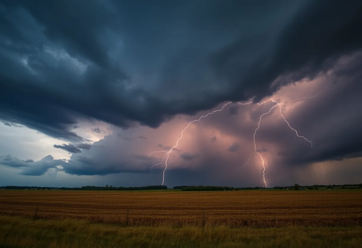
Severe Weather Alert: All Eyes on the Sky Today in Minnesota
Today, things are getting a bit wild as **the National Weather Service** has issued multiple tornado watches and severe thunderstorm warnings across southern and central Minnesota. If you’re in these areas, you might want to keep your umbrellas handy and your eyes peeled!
Tornado Watches and Warnings in Effect
Let’s break it down. A tornado watch is currently in effect until **11 p.m.** for several counties, including Dodge, Fillmore, Mower, Olmsted, Wabasha, and Winona. That means conditions are ripe for tornado formation, so stay alert! Meanwhile, there are active tornado warnings in Rice and Goodhue counties until **6:15 p.m.**. In these areas, if you’re in the line of potential danger, it’s a good time to stay indoors and stay safe.
If you’re located in Blue Earth, Faribault, Freeborn, Martin, Steele, and Waseca counties, you’re under severe thunderstorm warnings until **6:15 p.m.**. Some notable cities included in these warnings are Owatonna, Albert Lea, Waseca, Blue Earth, and several others. So, keep those weather apps handy and stay updated!
Keep an Eye on the Sky!
In a concerning update, an observed tornado was reported looking west from Fairmont. Residents in that area are urged to take cover immediately. These storms come with some serious news: over **4,000 people** have faced power outages for about two hours due to the storms, which indicates just how fierce the weather is.
Schools and Activities on Hold
A number of school districts have decided to play it safe and announced early closings. It’s a good night to cancel any afternoon or evening activities, folks. Safety comes first!
Moderate Risk and Widespread Alerts
The risk for severe weather today extends all the way from **St. Cloud** southward, including areas around the Twin Cities. The threat diminishes as you move to the north and west. If you’re in Brown, Chippewa, Cottonwood, Jackson, and a host of other counties, take note: tornado watches are valid until **8 p.m.** So yes, lots of weather happening!
A Meteorologist Weighs In
Meteorologists, including Joseph Dames, are keeping a keen eye on the tornado risk. It’s important to note that some tornadoes could remain on the ground for extended periods, which underscores the seriousness of the situation.
What Else to Expect?
After this stormy spell, we’re looking at cooler and breezy weather starting on Tuesday. The severe weather risk is expected to drop off midweek, providing a much-needed break. But we aren’t just talking about Minnesota; roughly **36 million people** across the nation are facing the risk of severe storms, from northern Minnesota stretching all the way to southwest Texas. There’s potential for tornadoes, hail, and damaging winds, so stay vigilant.
Be Prepared!
Residents in the Twin Cities are reminded to have their emergency plans ready and keep electronics charged, just in case things take a turn. With rapid atmospheric developments expected around **4 p.m.**, intense storm formations are likely to move eastward, leading to the threat of severe weather conditions. So keep that in mind.
More Alerts on Radar
We’re currently seeing radar-indicated tornado warnings issued for areas like Stearns, Wright, and Meeker counties. It’s a busy day for weather alerts, folks! NWS updates indicate a significant tornado threat, especially in southeastern Minnesota. Areas like Rochester and Mankato have been identified as having the highest risks for strong tornadoes.
Final Thoughts
Prepare for the possibility of large hail—up to **3.5 inches**—and incredibly strong wind gusts, potentially reaching up to **75 mph**. Multiple tornado watches are sure to follow throughout the day.
Stay safe everyone, and check in on your neighbors to make sure they are aware and ready for the weather ahead!
Deeper Dive: News & Info About This Topic
- CBS News: Minnesota Weather Severe Storms
- Wikipedia: Severe Weather
- NBC News: Severe Thunderstorms Rumble
- Google Search: Severe Weather Alerts
- Bring Me The News: Live Storm Updates
- Encyclopedia Britannica: Tornado
- Washington Post: Severe Storms Forecast
- Google News: Tornado Watch Minnesota
- Star Tribune: Weather Update Minneapolis
- Google Scholar: Meteorology
- KSTP: Severe Storms Forecast
- Google Search: Storm Preparations